
Australia’s meteorological agency has confirmed an El Nino event in the Pacific, potentially bringing drier, warmer weather to parts of the country.
While forecasts signal a “strong to very strong” El Nino climatic pattern, the Bureau of Meteorology says a potent system does not necessarily equate to strong weather impacts for Australia.
The US National Oceanic and Atmospheric Administration on Friday ascribed a 63 per cent chance of an El Nino of record-breaking strength developing later in the year.
Australia’s climate is driven by more than just the El Nino–Southern Oscillation patterns that cycles in the Pacific Ocean periodically, including the Indian Ocean Dipole, which is presently neutral, and regional sea surface temperatures.

Climate change caused by increasing concentrations of greenhouse gases trapping heat in the atmosphere is also pushing average temperatures higher and leading to more erratic and extreme weather.
The latest long-range forecasts from the bureau, which merge all potential climate drivers, point to below-average rainfall across parts of southern and eastern Australia over the next three months.
Higher daytime temperatures are predicted south of the tropics and warmer-than-normal evenings for much of the country.
Previous El Nino events have been linked to less rainfall in winter and spring in eastern Australia, higher temperatures in southern areas, and increased frost risk due to clearer skies.
“However, in a warming climate, past patterns are less reliable as a predictor of future impacts,” the bureau said.
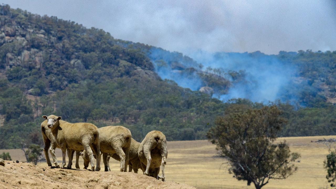
Fires agencies in the eastern states are already gearing up for a possible earlier, busier season, and some farmers say livestock and cropping decisions have already been complicated by the forecasts.
Other producers are wary of long-term weather predictions, particularly after livestock prices tanked amid a forecasted El Nino in 2023.
Despite its association with drier, warmer weather in Australia, El Ninos can still bring a mixed bag to the continent, with the last cycle in 2023 experiencing a dry August-October but a rainy November.
An El Nino is caused by the warming of the central and eastern tropical Pacific Ocean, generating more energy and cloud cover in the region and leading to higher rainfall in South America and parts of the US, with drier conditions typical for Australia.
They typically last six-12 months and the present pattern is projected to stick around until the latter half of 2026.
Climate Councillor Andrew Watkins, formerly of the Australian Climate Service and Bureau of Meteorology, said El Nino and climate change were an alarming combination, with the latter already adding about 1.5C of warming to the system.
“Together, climate pollution and El Nino are loading the dice towards record heat and fire conditions.”
Dr Watkins said the La Nina years – the opposite pattern linked to cooler and wetter weather in Australia – are already hotter than El Nino years of last century.
“We saw exactly that play out over summer when heat records tumbled across Australia during a La Nina.”